
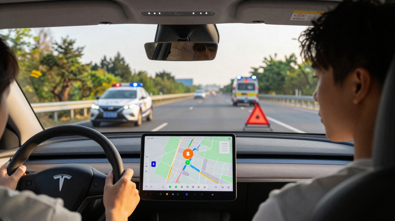
People who spend a lot of time on the road no longer rely solely on traffic bulletins and roadside signs. Apps such as Waze, Google Maps and Apple Maps have become constant companions behind the wheel. Waze is now introducing a feature specifically intended to reduce collisions at roadworks and incident sites - helping to protect both drivers and highway crews.
How Waze is shifting from sat-nav to safety app
Waze has been around since 2010, initially positioned as a conventional navigation app with a strong community element. Users report congestion, speed cameras, crashes and roadworks, and other motorists benefit from those updates in real time. According to the company, around 140 million people use the service worldwide; in France alone, the figure is roughly 17 million.
Waze wants to use that scale to tackle a long-standing problem: dangerous roadside situations where emergency or maintenance crews are working. Cars repeatedly pass far too close to maintenance vehicles, fail to spot road workers, or crash into areas that have already been secured after a breakdown. In several countries, road authorities rank these locations among the most hazardous workplaces.
"The new feature makes every journey with Waze a small building block for greater road safety - without the driver needing to do anything."
New warning for roadside operations
The key change is straightforward: Waze will display a dedicated warning when users are approaching a roadside operation involving highway maintenance or road services. This includes, for example:
- emergency carriageway repairs
- clearing and clean-up work after collisions
- maintenance of crash barriers, signs or tunnels
- visual inspections of bridges, the carriageway or drainage
In practice, the system works like this: the road workers’ service vehicle carries a tablet-based solution. When they head to an incident location, they can activate a report on the device. That report is sent directly into the Waze system and then appears on drivers’ smartphones as a clearly visible icon - in the French pilot, it showed as a small service vehicle on the map.
When a car using active Waze navigation gets close to the hazard area, two things happen:
- the pictogram appears on the map at the relevant point
- the smartphone also plays an audible alert
Once the driver has passed the area - or once the road crew switches the report off on their tablet - the warning disappears automatically.
Why this warning matters
The idea may look simple, but it tackles several risks at once. Many crashes occur because drivers notice unexpected situations too late. Hazard lights, beacons and warning triangles are required, yet they do not always register with every driver - particularly in darkness, rain or heavy traffic.
This is exactly where the combination of on-screen mapping and an audio cue comes in. Even if someone is absorbed in the radio or glances in the rear-view mirror, the audible prompt is still likely to cut through. That extra margin can give drivers time to:
- ease off the accelerator earlier,
- increase following distance,
- change lanes in good time, if needed.
"Every extra second of reaction time reduces the risk of rear-end collisions and dangerous last-second swerves - those are exactly the seconds Waze is trying to create."
Working with authorities: test regions as a preview
For the rollout, Waze partnered in France with the Ministry of Transport and regional road administrations. The public bodies not only provide the tablets; they also set the rules for when and where alerts should be active. The aim is to prevent incorrect or outdated warnings remaining in the system.
The setup was first trialled in several regions in the west of the country, including Brittany and Pays de la Loire, as well as in the south-west. In these test areas, the alerts were used in live, real-world operations. Feedback from local road depots has been positive: staff report that traffic drives noticeably more cautiously close to the marked zones.
Based on these trials, those responsible are planning to expand the scheme nationwide. Similar partnerships could also follow in other European countries - for example with motorway operating companies or regional authorities in German-speaking areas. From a technical standpoint the feature can be used globally; what’s mainly needed is the right local partners.
A building block for the “connected road”
Authorities view the collaboration with Waze as an early step in a wider shift in road transport. Over the longer term, the goal is a form of “connected road”, where information about hazards and obstacles flows automatically into navigation systems, vehicle computers and potentially even driver-assistance systems.
This could eventually include, among other things:
- automatic warnings for suddenly appearing obstacles
- more precise information on active roadworks zones
- alerts for extreme weather such as black ice or heavy rain
- immediate notifications for serious crashes or wrong-way drivers
Even today, many motorway authorities use digital traffic-management systems that display queues and closures on roadside message boards. Waze is effectively bringing that same logic to smartphones - making it accessible to far more people, including drivers in older vehicles without modern online navigation.
Opportunities and risks for motorists
While the new alert offers clear benefits, it also comes with the familiar downsides of modern assistance systems. If drivers place too much trust in app and sat-nav prompts, they can become less vigilant themselves. Traffic specialists have warned for years that an increasing number of digital helpers can ultimately become a source of distraction.
The danger of phone use at the wheel is well established: every added notification and every pop-up can tempt a glance at the screen. Waze is trying to counter that by using very simple symbols and a clear sound. The intention is to inform quickly without encouraging drivers to stare at the display.
What matters most is how people behave when the alert appears. Anyone who reflexively looks down at their phone while travelling at 130 km/h on a motorway is increasing their risk. Anyone who hears the tone, keeps their eyes on the road and simply lifts off a little earlier is taking advantage of the genuine safety benefit.
What German users can take away from this
Although the project described here began in France, several points translate directly to everyday driving in German-speaking countries:
- apps like Waze are now far more than route planners
- real-time data from authorities and road depots significantly increases usefulness
- these kinds of partnerships could become the norm in future - at home as well
- it’s worth enabling warning functions deliberately and keeping audio switched on
On motorways and high-speed roads in particular, early notice of a roadside operation can save lives - for instance when a gritting vehicle is stopped on the hard shoulder, or when workers are separated from live traffic by nothing more than cones. Many collision statistics repeatedly flag these scenarios as especially critical.
Terms and background: what the idea is really about
At its core, the term “connected road” refers to digital communication between infrastructure, vehicles and services. Traffic lights, cameras, sensors, roadside stations and apps all send data to central systems, which then generate warnings, speed limits or diversions.
Navigation apps like Waze play a dual role in this setup. On the one hand, they gather large volumes of movement data and congestion information from users. On the other, they act as a distribution channel that can broadcast relevant hazard alerts quickly and at scale.
A key future question is how directly these warnings will be fed into cars themselves. Modern vehicles can already receive congestion and hazard messages via online services. If, in future, data is shared seamlessly between road authorities, apps and car manufacturers, a much denser safety infrastructure could emerge - with far more warnings arriving seconds before a critical point.
Until then, Waze’s latest change shows how practical, small steps can still make a difference. A simple button on a tablet in a service vehicle, a pictogram in an app, a short tone - that’s all it takes to turn an anonymous data network into a concrete safety tool.






Comments
No comments yet. Be the first to comment!
Leave a Comment